Northwest Metro Transportation Plan
Project Background
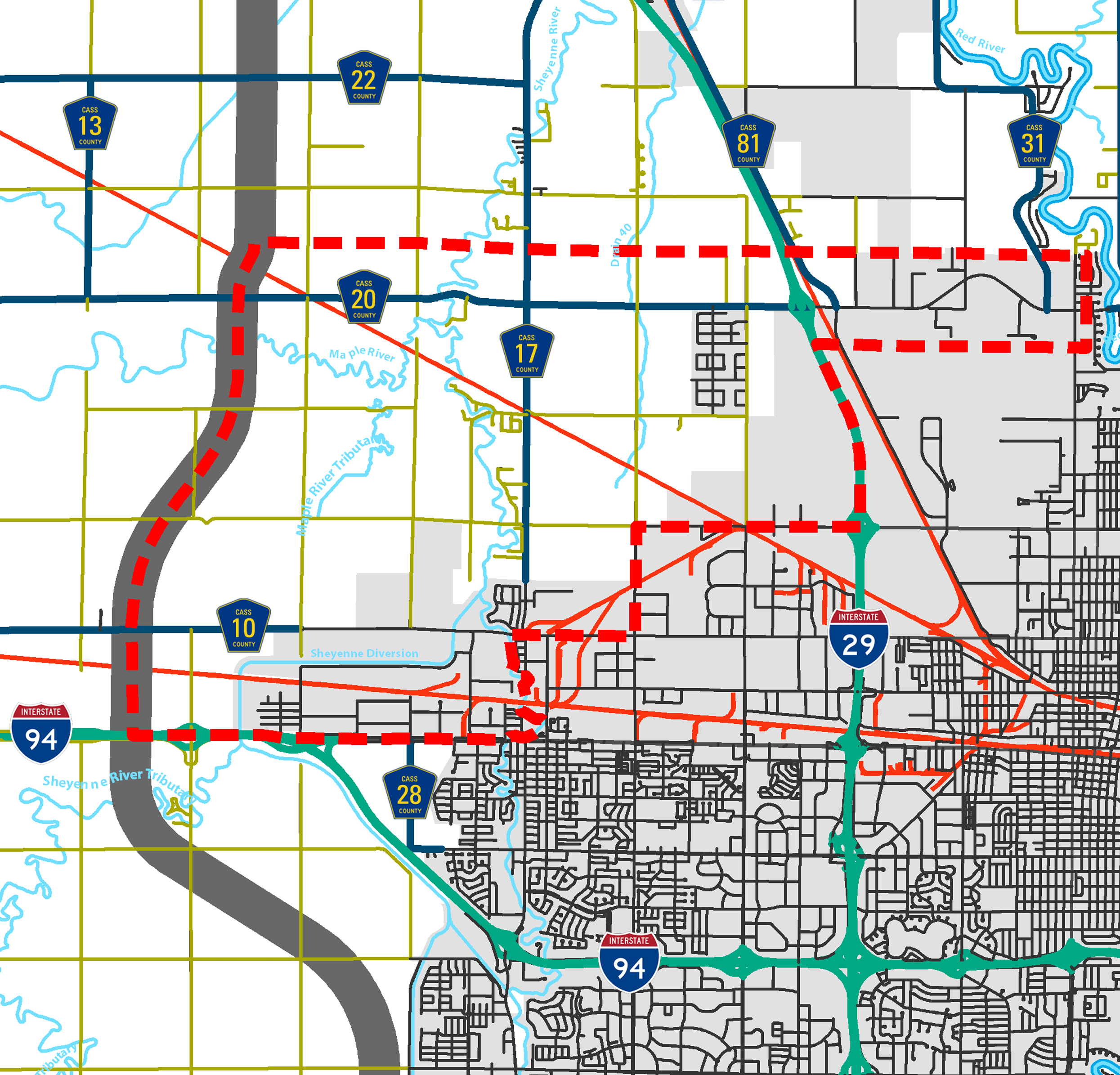
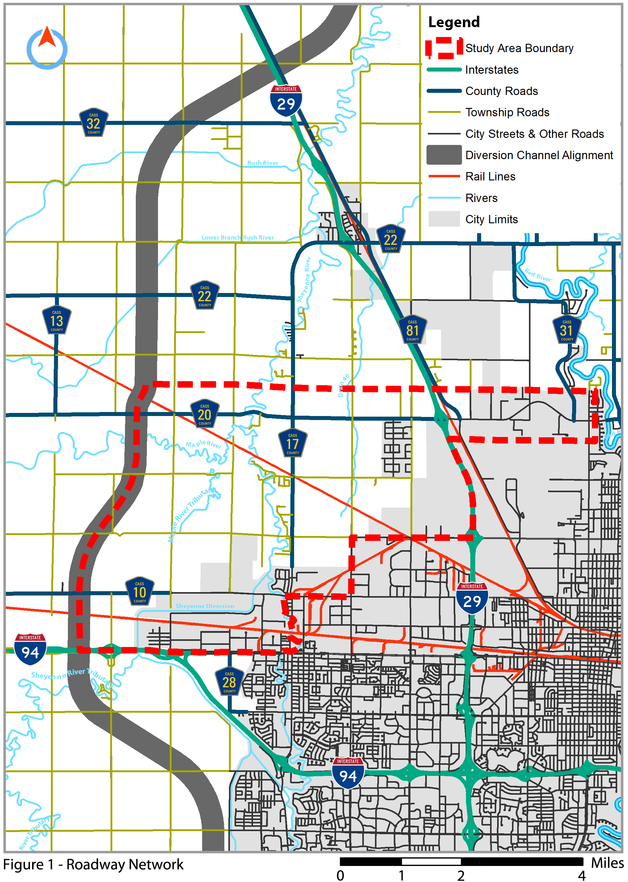
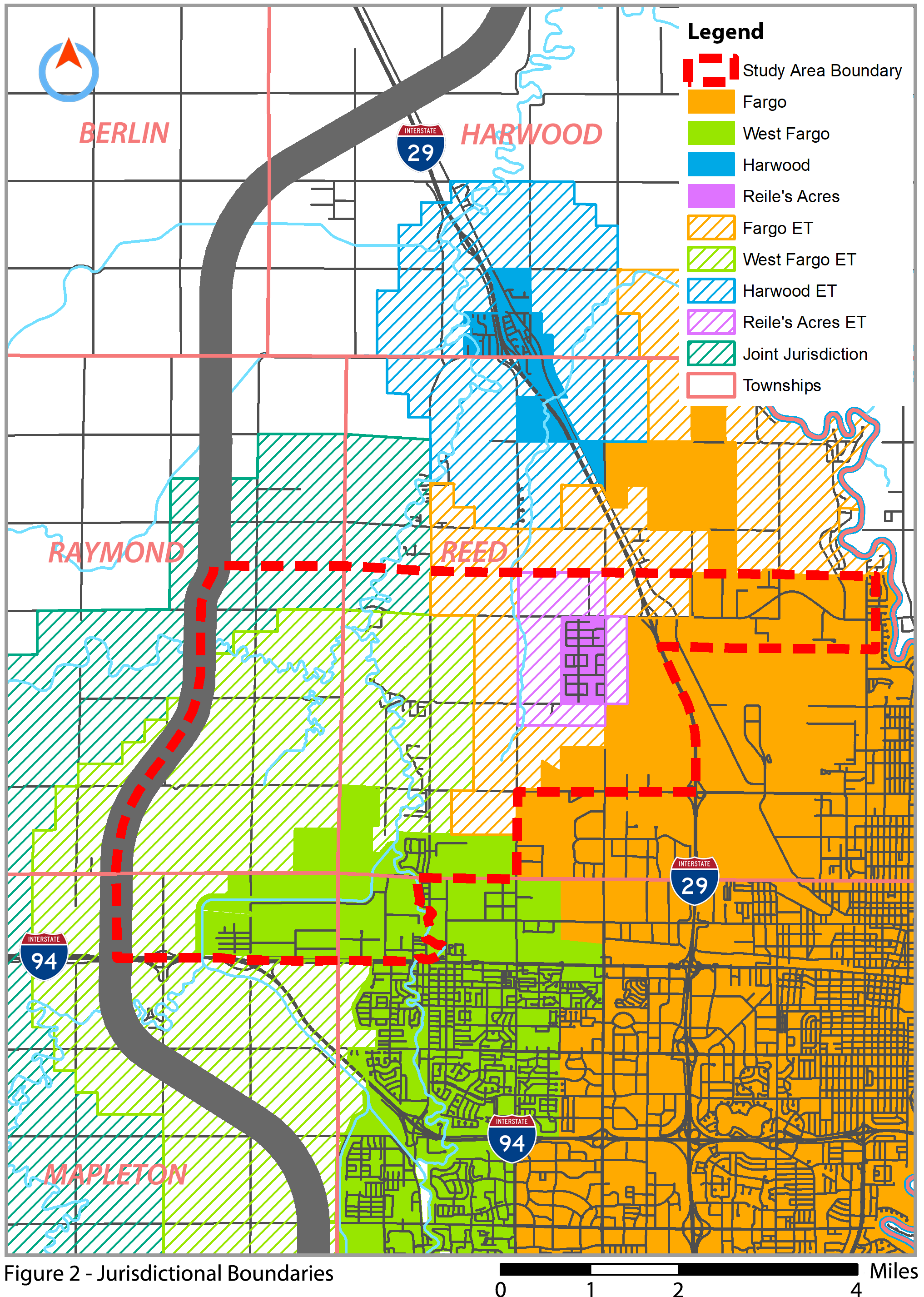
The study area for the Northwest Metro Transportation Plan is bounded to the north by 40th Avenue North/County Road 20, to the south by 19th Avenue North and Main Avenue/Interstate 94, to the east by Interstate 29, and to the west by the Fargo-Moorhead Area Diversion Alignment. The study area also extends east of Interstate 29 along 40th Avenue to University Drive.
Historically, the northwest portion of the Fargo-Moorhead metropolitan area has been largely rural and heavily oriented towards rural residential and agricultural uses, with industrial uses confined to the industrial parks of the City of Fargo and City of West Fargo. However, recent developments have led the City of Fargo to improve utility services as well as other infrastructure planning efforts which will assist in expanding municipal infrastructure to areas north and northwest of the city. Additionally, the City of Fargo and City of West Fargo have established a new extraterritorial agreement in coordination with a recent utility service agreement between the two cities. The City of Reile’s Acres has also seen a notable increase in residential development within its city’s limits.
In response to these recent activities and in an effort to stay ahead of development pressures, Metro COG and regional jurisdictions are interested in developing a transportation plan for the northwestern portion of the Fargo-Moorhead Metropolitan area. The proposed Northwest Metro Transportation Plan will provide a framework for transportation system improvements and tie together infrastructure planning currently underway in the area.
Project Objective
The objective of the Northwest Metro Transportation Plan is to review existing conditions, consider transportation-related infrastructure capacity, establish framework strategies for system improvements, and produce a comprehensive transportation plan. The intended outcome of this project is to develop an implementation plan for future roadway arterials and collectors, identify needs for both current and future corridors in terms of operational capacity, and develop policy recommendations to guide transportation decisions and future land use in the study area.
The Northwest Metro Transportation Plan is intended to provide guidance for growth and development for the northwestern portion of the Fargo-Moorhead metropolitan area, as well as general multimodal transportation and land use recommendations to guide implementation. The scenario-based transportation plan will outline opportunities and constraints, preservation needs, and investment priorities to substantiate inclusion of roadway projects in local capital improvement programs and Metro COG’s Transportation Improvement Program.
Project Resources
Public Input Videos
Project Contact Information
Adam Altenburg
altenburg@fmmetrocog.org
701-532-5105
Fargo-Moorhead Metropolitan Council of Governments
Case Plaza, Suite 232
One 2nd Street North
Fargo, ND 58102