The Heartland Trail Study
in Clay County
Final Document
APPENDICES
Project Description
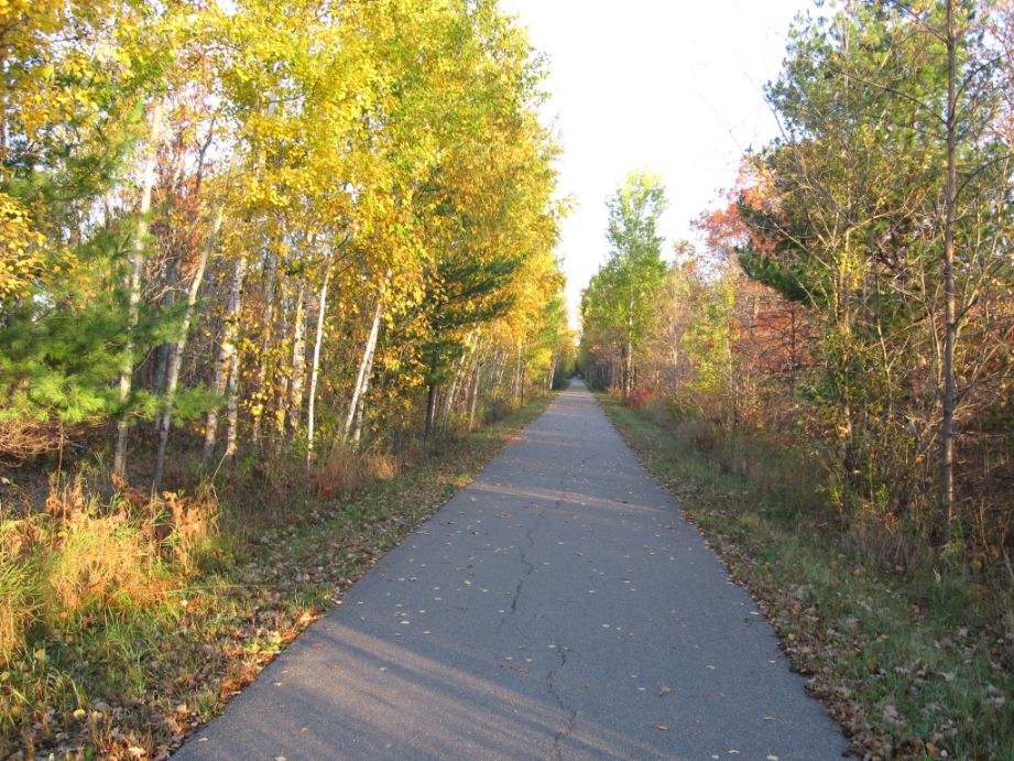
The current Heartland State Trail winds its way through the scenic landscapes of north-central Minnesota, serving as a recreational and transportation corridor for residents and visitors alike. This paved state trail caters to a wide range of outdoor enthusiasts, offering opportunities for walking, running, cycling, snowmobiling, and cross-country skiing throughout the year.
Currently spanning a total of 49 miles, the Heartland State Trail stretches from Park Rapids to Cass Lake, providing a seamless pathway for leisure and connectivity. Initially constructed in 1976, the trail saw further expansion in 2002 with the addition of a segment from Walker to Cass Lake, enhancing accessibility and fostering regional connectivity. In the communities where it has already been constructed, the Heartland State Trail has created opportunities for recreation, everyday transportation, and has served as an economic engine for tourism and small businesses along the Trail.
Planning efforts to extend the trail (whether state trail, regional trail, or otherwise) through Clay County commenced in 2014. These collaborative planning efforts with local authorities, stakeholders, and the public commenced in 2014. These endeavors have led to the identification of potential routes for the trail's extension through the County. The objective of this study is to make final decisions about trail placement through in-depth public and stakeholder engagement which will move us one step closer to the construction of the Clay County segment of the Heartland Trail!
Frequently Asked Questions
Northwest Minnesota does not have a nearby state trail, as the rest of the state does. Today residents of Clay County are missing out on the benefits and quality of life that such a trail would have to offer.
This trail would provide a designated route for those seeking a variety of recreational opportunities in Clay County. The trail would link cities, towns, and parks along the route and provide residents of Clay County with a safe and scenic recreational corridor.
No. No land will be condemned for the purposes of this trail. Any land needed for the construction of this trail will be purchased or an easement will be set up on a voluntarily basis by the adjacent landowners.
This trail will be designed for all types of users. Runners, walkers, bicyclists, in‐line skaters, etc. In the winter cross country skiers and snowmobiles will be allowed to use the trail. If sufficient corridor width is available a separate treadway may be made available for horseback riding. This treadway may also be the best option for snowmobiles and/or cross country skiers. ATVs will not be allowed on the trail.
It is expected that users will come from all parts of Clay County and beyond. With the trail connecting to the Fargo‐Moorhead area, many residents from Fargo‐Moorhead are expected to use the trail. A mix of users ranging from families to long‐distance bicyclists are expected to enjoy this amenity.
At this stage it is hard to say exactly when the entire Clay County Heartland Trail will be built. Smaller segments of the trail may be built through towns such as Hawley and Glyndon with the larger segments being built further in the future. This is all contingent on funding for the trail.
With nearly 600 miles of state trails in Minnesota, many of the trails travel through lands adjacent to private properties. There have been little to no complaints from such landowners about the users of the trails. Many users of these trails are using the trails to enjoy the outdoors and as such are responsible stewards of the land and respectful of adjacent properties.
The cost of this trail is still being evaluated. Costs will vary based on terrain, wetlands, and many other factors. In addition to these costs, possible easements and property purchasing could also incur costs to the trail building effort. As a result of this study, planning-level cost estimates will be developed.